Platja de la Martinenca or del Ciment
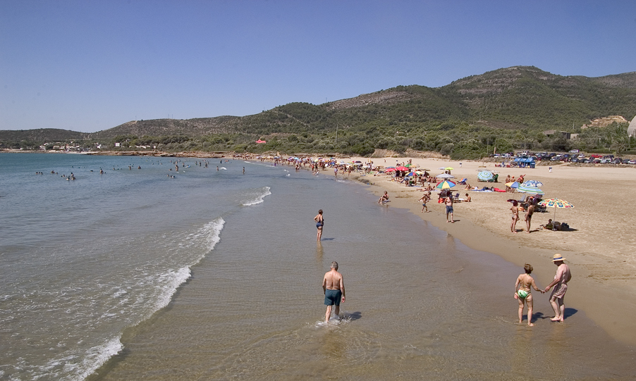
La Martinenca Beach, also known as El Ciment Beach, is located in Alcanar, (southern Terres de l'Ebre). Of considerable size, some 320 m long by 42 m wide, Platja de la Martinenca has fine golden sand, calm waters and is surrounded by vegetation, mainly oak groves and dwarf palms. From the beach, the profile of the low hills that appear to decorate the Montsià range stands out.
Bordered to the east by the breakwater of the industrial port, Platja de la Martinenca, tends to have a medium to high occupation, despite being far from the centre of Alcanar. This is mainly due to its size and the services it offers, including car parking, beach bars, sun lounger, parasol and pedalo hire, toilets and showers. Moreover, within a stone’s throw of the beach there is a variety of restaurants, hotels and guesthouses.
Lovers of water sports, and sailing in particular, have several options for enjoying an unforgettable day, as Alcanar Marina is less than 3 kilometres away.
HOW TO FIND IT
Platja de la Martinenca / Platja del Ciment
Geolocation
Platja del Ciment s/n
43569 Alcanar
Coordinates: 40º 53' 36,347" N 0º 48' 58,450" E
SERVICES
- Bars-restaurants-beach bars
- Showers
- Toilets
- Daily cleaning
- Signage
- Litter bins
- Parking
MORE INFORMATION
- Type of sand: Fine golden sand.
- Width (m): 42 metres
- Length (m): 320 metres
- Access: La Martinenca Beach can be reached via the A-7 motorway (Exits 41 and 42) and the N-340 main road. By train to L'Aldea station. And also by interurban bus (Hife).
- Classification: Couples, Families, Hikers,
- Surroundings: Les Cases d’Alcanar and Marina