Platja de l’Estany or Port de l’Estany Gras
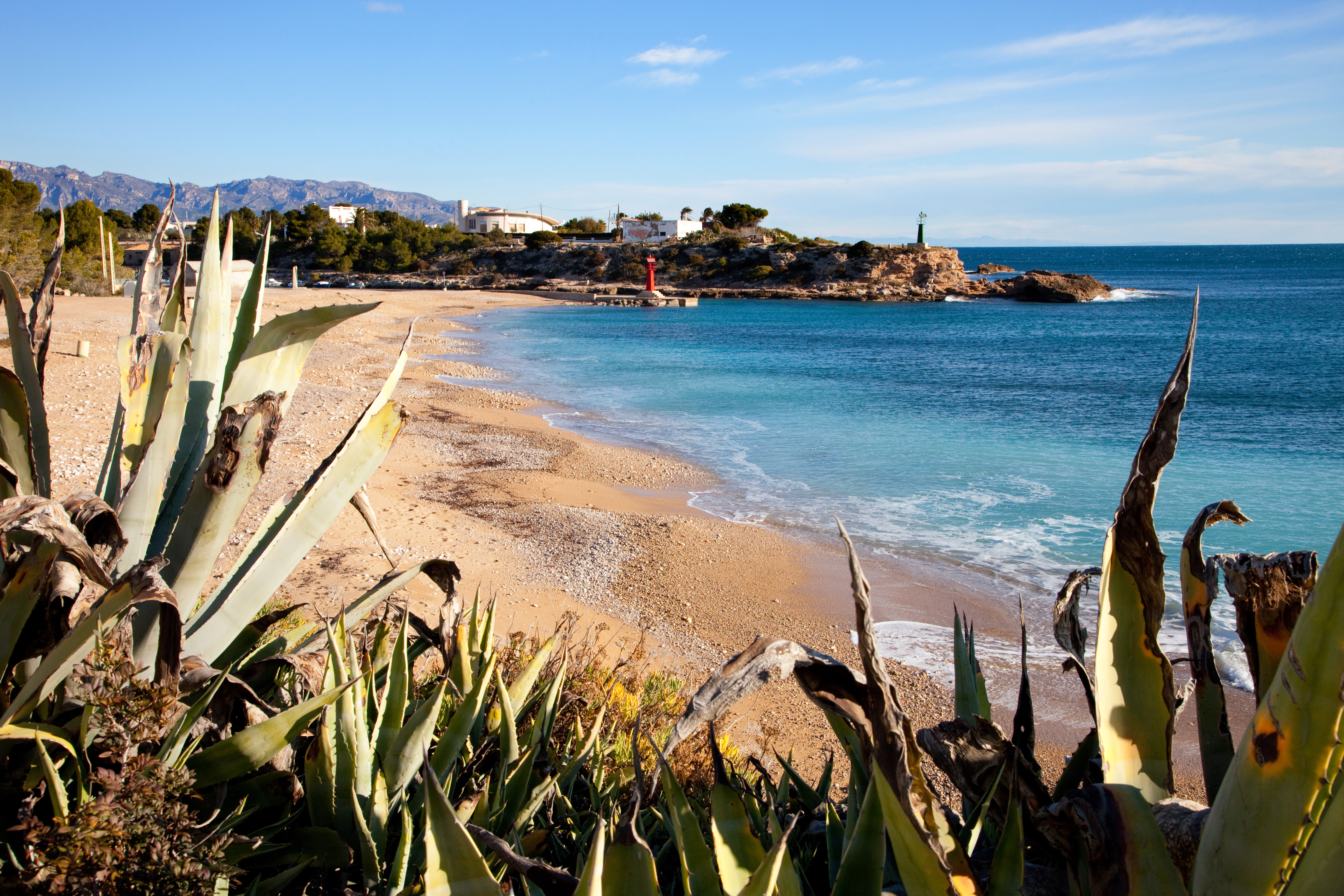
Platja de l'Estany or Port de l'Estany Gras beach in L’Ametlla de Mar (northern Terres de l'Ebre) was a natural harbour for the local fishing boats until around 1920, when the present-day port was built. Some 200 m long and 30 m wide, L'Estany Beach has fine golden sand combined with gravel and the waters have a moderate swell, depending on the wind direction.
L'Estany Beach offers several services, including car parking, showers, toilets, a lifeguard service, a boardwalk for people with reduced mobility, signage, a beach bar, and bars and restaurants on the shore. One of its most precious attributes and the reason it stands out is the high ecological value of the area, with a rich native vegetation in which pine woods, kermes oak and palmetto stand out. It also has a very varied marine fauna that it is a great attraction for diving.
HOW TO FIND IT
Platja de l’Estany
Geolocation
Paratge Urbanització Port Estany, s/n
43860 L’Ametlla de Mar
Coordinates: 40º 52' 6,807" N 0º 47' 32,882" E
SERVICES
- Parking
- Toilets
- Showers
- Beach bar
- Bar-restaurants
- Boardwalk for people with reduced mobility
- Daily cleaning
- Signage
MORE INFORMATION
- Type of sand: Fine sand and pebbles
- Width (m): 30 metres
- Length (m): 200 metres
- Access: By car from the N-340 main road and the A-7 motorway (Exit 39 L'Ametlla de Mar). By train, Tarragona-Tortosa line, L’Ametlla de Mar station. By interurban bus.
- Classification: Couples, Families, Hikers,
- Surroundings: L’Ametlla de Mar